
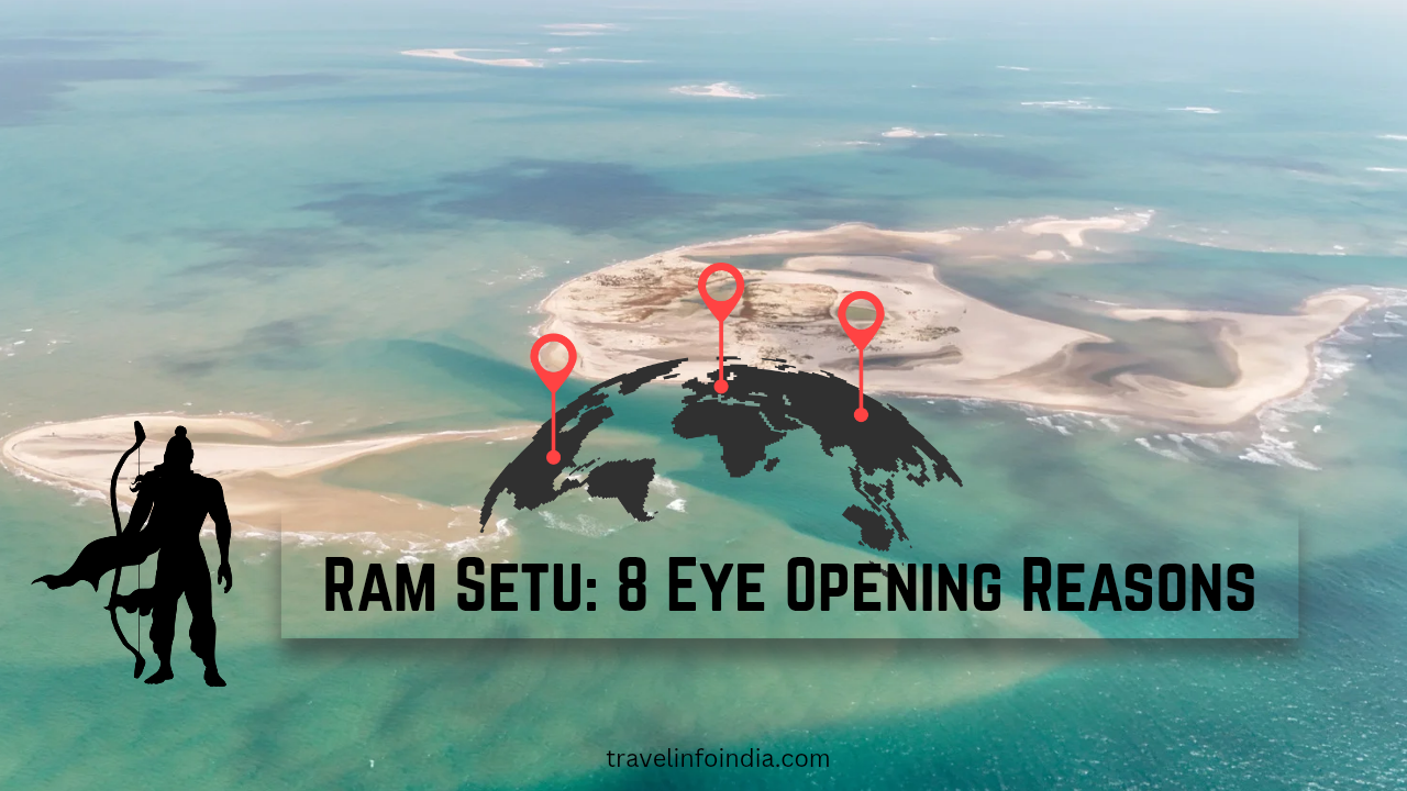
Ram Setu: 8 Eye Opening Reasons This Path From India To Lanka Can Not Be Crossed
Stretching across turquoise waters of the Palk Strait, connecting India’s Rameswaram to Sri Lanka’s Mannar Island, lies one of most debated and divine structures on Earth Ram Setu, or Adam’s Bridge.
According to Ramayana, this ancient bridge was built by Lord Rama’s Vanara (monkey) army, led by Hanuman and Nala, to rescue Goddess Sita from demon king Ravana in Lanka. While science sees it as a natural formation, faith regards it as sacred proof of a bygone epic.
Ram Setu stands as a timeless symbol — where mythology meets geology, and faith challenges feasibility.
Location: Between Rameswaram (Tamil Nadu, India) and Mannar Island (Sri Lanka)
Also Known As: Adam’s Bridge
Best Time to Visit: October – April
Official Tourism Link: https://www.tamilnadutourism.tn.gov.in

The Epic Connection – Ramayana’s Bridge to Lanka
In the Valmiki Ramayana, when Sita was abducted by Ravana and taken to Lanka, Lord Rama sought help from the Vanara king Sugriva and his army. When they reached the sea at Rameswaram, Rama prayed to the Sea God for a way to cross.
Under guidance of Nala, an engineer among the Vanaras, they built a floating bridge using stones inscribed with the name of Lord Rama. Miraculously, these stones floated on water — forming a passage from India to Lanka, allowing Rama and his army to march across and triumph in the great battle.
“Rama ordered the construction of a bridge,and the ocean gave way to devotion.”

This bridge, as described in scriptures, was 100 yojanas long (about 130 km) and 10 yojanas wide (around 13 km).
Even today, satellite images show a chain of limestone shoals beneath the shallow waters — matching exact location mentioned in the epic.
Location and Geography
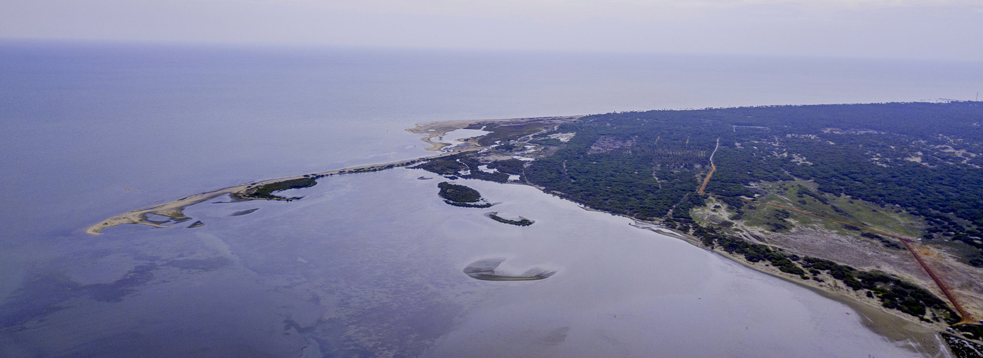
Ram Setu begins near Dhanushkodi, the eastern tip of Rameswaram Island in Tamil Nadu, and extends up to Mannar Island in Sri Lanka.
Length: ~48 km (visible stretch)
Depth: Around 3–10 feet under water
Structure: Chain of limestone shoals and sandbanks
Highlights:
bridge is visible in low-tide conditions.
water on both sides shows contrasting colors — shallow turquoise on the Indian side, and deep blue on the Sri Lankan side.
According to NASA satellite imagery, this structure is not entirely natural — parts appear man-altered.
Official Source: https://www.isro.gov.i
Google Maps View: Ram Setu on Maps
Ram Setu – Historical and Scientific Perspectives
Geological View
Scientists describe Ram Setu as a chain of natural limestone shoals, possibly formed due to sea-level changes thousands of years ago.
Some researchers from Geological Survey of India (GSI) and ISRO have dated the sand and coral formations to around 7,000–5,000 years old—roughly aligning with the Ramayana’s timeline.
A 2017 study by Discovery Science Channel (USA) noted that:
The sand of the bridge is around 4,000 years old, but the underlying stones are much older suggesting human involvement.
Archaeological Relevance
Rameswaram and Dhanushkodi are dotted with temples and sacred sites that align with Ramayana’s descriptions, including:
Ramanathaswamy Temple, where Rama worshipped Lord Shiva
Kodandaramaswamy Temple, marking the spot where Rama met Vibhishana (Ravana’s brother)
Dhanushkodi, believed to be the starting point of Ram Setu.
Why the Path Is Infeasible Today
Modern explorers sometimes wonder:
If Ram Setu exists, why can’t we simply walk or drive across it?
The answer lies in a mix of geology, oceanography, and environmental risk.
The Shoals Are Not Solid Ground
Unlike a stable rocky foundation, Ram Setu consists largely of:
-
Loose sediments
-
Porous limestone
-
Coral fragments
These materials shift over time, especially under wave action. Attempting to walk across them would be like walking on a partially submerged sand dune—unpredictable, uneven, and often sinking under weight.
Depth Variations Make Travel Dangerous
While the water appears shallow from satellite images, depth varies drastically:
-
Some areas barely cover the shoals.
-
Others drop suddenly.
-
The constant flow of tides makes footing uncertain.
This is not a stable, uniformly exposed landmass.
High Current Speed and Rough Seas
The area between India and Sri Lanka lies where the Bay of Bengal and the Indian Ocean meet—a zone of high turbulence. Strong currents continually reshape the shoals, ensuring instability.
Waves can be powerful enough to:
-
Erode the sandbanks
-
Shift underwater ridges
-
Make walking or construction impossible
Ship Navigation Is Restricted for a Reason
Large vessels avoid this area entirely. If the route were solid or traversable, smaller ships or boats might risk passing through. But the seabed shifts so often that even navigation maps cannot accurately predict its contours.
The Tectonic and Coastal Dynamics Work Against Stability
The region’s geological history shows:
-
Constant sediment deposition
-
Coral reef growth and decay
-
Recurrent cyclonic activity
-
Sea level changes over centuries
Anything built—even naturally—gets reshaped or submerged over time. That’s why the “path” that may have been more accessible thousands of years ago looks so fragmented today.
Ram Setu: 8 Eye Opening Reasons This Path From India To Lanka Can Not Be Crossed
Nearby Attractions
1. Rameswaram – The Land of Lord Rama
A major pilgrimage destination and one of the Char Dhams of India.
Must-visit sites:
Ramanathaswamy Temple – with 22 holy water wells
Pamban Bridge – India’s first sea bridge
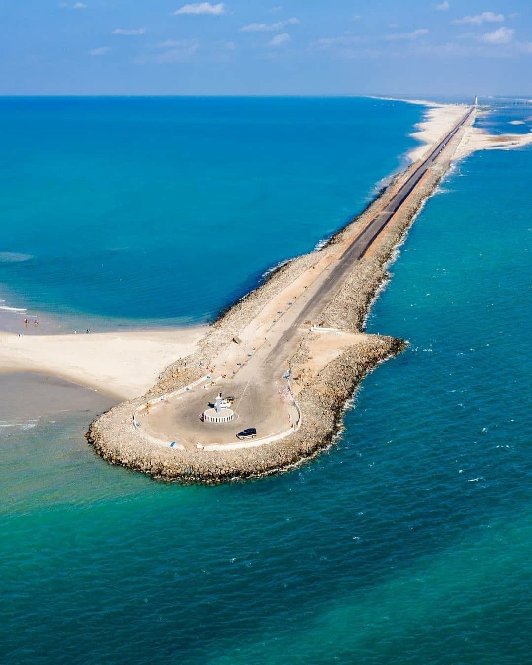
Dhanushkodi Beach – “Ghost Town” destroyed in 1964 cyclone
APJ Abdul Kalam Memorial – dedicated to India’s Missile Man

2. Dhanushkodi – The Lost Town
Once a bustling port town, Dhanushkodi was destroyed by a massive cyclone in 1964. Today, its ruins stand as a haunting reminder of nature’s power.
You can see exact spot where the Ram Setu begins — a surreal experience for any traveler or devotee.
Tip: Visit early morning for golden sunrise views over the sea.

3. Mannar Island (Sri Lanka)
On the opposite end of the bridge lies Mannar Island, known for its churches, coral reefs, and pearl fishing.
If diplomatic and travel conditions allow, this is an amazing spot to witness the southern tip of the Ram Setu chain.
Travel Guide
How to Reach:
By Air: Nearest airport – Madurai (170 km)
By Train: Rameswaram Railway Station (connected to major cities)
By Road: Regular buses from Madurai, Tiruchirappalli, and Chennai
Local Transport: Auto rickshaws, rental bikes, and private taxis are easily available.
Stay Options:
Hyatt Place Rameswaram
Daiwik Hotel Rameswaram
Hotel Tamil Nadu (TTDC)
Local guesthouses near temple
Book Stays – Tamil Nadu Tourism
Ram Setu: 8 Eye Opening Reasons This Path From India To Lanka Can Not Be Crossed bridge of Ram Setu is not merely the chain of shoals—it is the bridge between imagination and inquiry, devotion and discovery.
Whether seen as a sacred remnant of a divine journey or as a fascinating geological wonder shaped by the sea, Ram Setu continues to connect hearts and minds across time—proving that not all bridges must be crossed physically to be meaningful.


[…] Ram Setu: 8 Eye Opening Reasons This Path From India To Lanka Can Not Be Crossed […]
Your point of view caught my eye and was very interesting. Thanks. I have a question for you. https://www.binance.com/id/register?ref=UM6SMJM3