
Top10 Best Malls in India You Must Visit in 2025
In 2025, India’s top malls are more than just shopping destination.
they are experiential hubs offering luxury, entertainment, gastronomy, and more under one roof. Here’s a curated list of India’s biggest and best malls, each with signature brands and standout attractions.
List Of Best Mall In India
Top10 Best Malls in India You Must Visit in 2025
1. Lulu International Shopping Mall, Kochi (Kerala)
Location: Edappally Junction, Kochi, Kerala
-
Over 235 retail outlets featuring brands like Myntra, Zara, Louis Philippe, Pantaloons, international luxury boutiques, and the extensive Lulu Hypermarket. Reddit
-
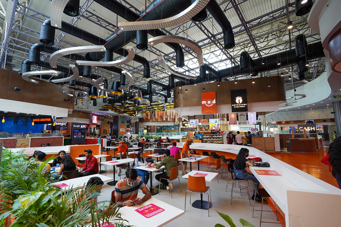
Family attractions include a 9-screen PVR multiplex, South India’s largest ice skating rink, bowling alley, trampoline park, and a 2,500‑seater food court with 9 restaurants and 6 cafes.


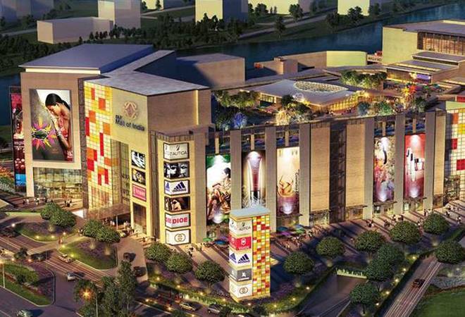
2. DLF Mall of India, Noida (Uttar Pradesh)
Location: Sector 18, Noida (near Noida Metro Station)
-
Zonal layout: International Boulevard, The High Street, Market Place, Family World, Leisure Land.
-
Brands featured: Zara, H&M, Marks & Spencer, Tommy Hilfiger, Puma, Nike; plus Hamleys, Forever 21, Superdry.
-
Highlights: 7‑screen PVR Cinemas (including 4DX and PVR XL), a kids’ arena, food court, and superior parking/shuttle facilities.
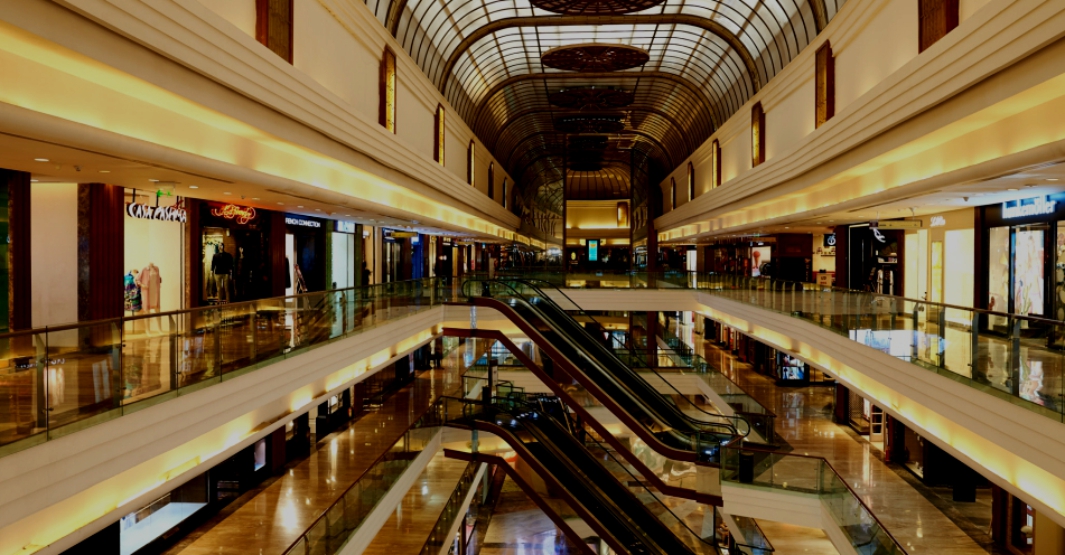
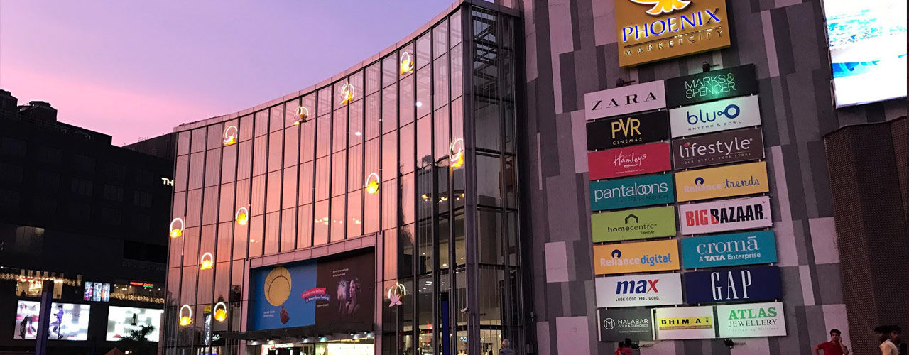
3. Phoenix Marketcity, Mumbai (Lower Parel)
Location: LBS Marg, Kurla West, Mumbai
-
Home to High Street Phoenix and Palladium Mall, together hosting over 500 stores. Indiatimes+2Wikipedia+2Wikipedia+2
-
Luxury and premium brands at Palladium include Gucci, Louis Vuitton, Prada, Michael Kors, while High Street hosts mainstream and designer fashion.
-
Entertainment: South Asia’s largest 20‑lane bowling alley, multiplex, rooftop events, art installations.

4. Phoenix Marketcity, Mumbai (Pune branch)
Located in Viman Nagar, Pune, with ~1.19 million sq ft retail space. It houses over 350 stores. Wikipedia
-
Famous brands: Lifestyle, Max, Zara, Aldo, Bata, Crocs, Bath & Body Works.
-
Entertainment zones: PVR multiplex, kids play area, gaming arcades, large food court.


5. Phoenix Marketcity, Bengaluru (Whitefield)
Location: Mahadevapura, Whitefield Road, Bengaluru
-
The largest retail mall in Bengaluru (~1 million sq ft), with 296+ stores.
-
Key tenants: PVR Cinemas, Lifestyle, Reliance Trends, United Colors of Benetton, FabIndia.
-
Attractions: multiplex, gaming zones, themed events, food court featuring multi-cuisine chains.
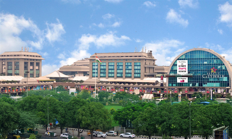
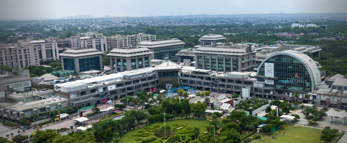
7. Select Citywalk, New Delhi (Saket)
Location: A-3, District Centre, Saket, New Delhi
-
A premium lifestyle mall with ~1.3 million sq ft and over 200 upscale shops. Indiatimescomingkeys.com
-
High-end fashion from Gucci, Prada, Tom Ford, Indian designers like Raw Mango, Anita Dongre.
-
Dining venues include Lavelle, Social, K3, Chili’s, and an integrated 6‑screen multiplex.
-
Frequent events: fashion shows, cultural carnivals, brand exhibitions.
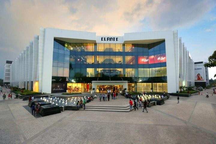
8. Elante Mall – Chandigarh, Punjab
Location: Industrial Area Phase I, Chandigarh
-
Over ~1.15 million sq ft; with 200+ stores.
-
Brands: Zara, H&M, Coach, Tommy Hilfiger, Sephora, Mothercare.
-
Multiplex cinema, food court, children’s play zones, and seasonal events.
9. Inorbit Mall, Hyderabad (Telangana)
Location: Mindspace IT Park, Madhapur, Hyderabad
-
Retail area around 1 million sq ft, with 200+ stores across three levels.
-
Known brands: Lifestyle, Max, Puma, Apple Premium Reseller, Reliance Digital, Cinema multiplex, Game arcades, bowling alleys.

10. Quest Mall – Kolkata, West Bengal
Location: Syed Amir Ali Avenue, Ballygunge, Kolkata
-
Around ~1.2 million sq ft retail space.
-
Upscale brands: Louis Philippe, Tommy Hilfiger, Apple, Samsung, Sephora.
-
Features: four-screen multiplex, fine dining, spa services, boutique stores.

These Malls Stand Out in 2025
Reasons
- Size & Scale
Each mall offers at least 1 million sq ft of shopping space—some exceeding 3 million sq ft—making them urban landmarks that redefine destination retail.
- Brand Diversity & Mix
From global luxury labels like Gucci, Louis Vuitton, Prada, to trusted Indian fashion names like FabIndia, Lifestyle, Pantaloons, each mall features a curated mix to satisfy diverse shopper preferences.
- Innovative Entertainment
Multiplex cinemas (PVR chains across each), bowling alleys, ice-skating rinks, gaming zones, kids play areas, and regular events or fashion shows make these malls immersive beyond shopping.
- Dining & Food Courts
Spacious multi-cuisine food courts, fine-dining restaurants like The Coffee Bean and IMFL lounges, and international cuisine in cafes and eateries ensure a gastronomic journey from street food to gourmet.
Top10 Best Malls in India You Must Visit in 2025
Featured Brands in Each Mall
| Mall Name | Notable Brands & Anchors |
|---|---|
| Lulu Mall Kochi | Lulu Hypermarket, Zara, Louis Philippe, Disney, H&M, PVR |
| DLF Mall of India | Zara, Puma, Nike, Hamleys, H&M, Tommy Hilfiger, PVR |
| High Street Phoenix / Palladium | Gucci, LV, Michael Kors, Sephora, Apple, Cinema |
| Ambience Mall | Zara, Armani Exchange, H&M, Van Heusen, fine dining, art galleries |
| Select Citywalk | Prada, Tom Ford, Anita Dongre, Social, Chili’s, Cinepolis |
| Phoenix Marketcity (Mumbai/Pune/Hyderabad/Bangalore) | Lifestyle, Max, United Colors of Benetton, Reliance Digital, PVR, gaming zones |
India’s mall culture is evolving rapidly. As more luxury brands now launch domestically—from Louis Vuitton’s Rani Pink collection to Bulgari’s mangalsutra line shopping locally is becoming attractive to young, affluent consumers.


[…] Top10 Best Malls in India You Must Visit in 2025 […]
[…] Top10 Best Malls in India You Must Visit in 2025 […]
[…] Top10 Best Malls in India You Must Visit in 2025 […]
Thank you for your sharing. I am worried that I lack creative ideas. It is your article that makes me full of hope. Thank you. But, I have a question, can you help me?